Listen Here
Listen on your iPhone with Apple Podcasts
If you are on your phone, go to the Apple Podcasts app and search for “Norwich Historical Driving Tours.”

Download Transcript Download Map
If you enjoy the podcast, please consider joining NHS today as a member. Becoming a member will help us meet our operating costs during this Covid-19 crisis. Click here to join online
Adult podcast narrated by Linda Cook, Kristin Graham, Bruce McLaughry, Emily Myers, David and Katharine Navins, Bob Parker, Sarah Rooker, Lily Trajman, and Emily and Gibb Zea
Tour Route
Begin and end the Driving Tour at Norwich Historical Society
277 Main Street
 Stop 1: Foley Park
Park so you can see the river
Foley Park is at the confluence of the Connecticut River and Blood Brook. Abenaki people fished along the banks of the Kwanitekw or “Long River.” In 1765 the families of Nathan Messenger and Samuel Hutchinson were the first English settlers to winter over in a log hut here on the pint, where the bridge now lands on the Norwich side.
 Stop 2: Hatch-Peisch house
236 US Route 5
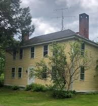
This 1773 house is said to be the first frame house in Norwich, built by Joseph Hatch, who arrived from Connecticut in the 1760s. In 1768 the first town meeting was held in his cabin, near the site of this house.
 Stop 3: Ferry Place
Intersection of Loveland Road and Route 5
This area at the foot of Loveland Road was known as “Ferry Place.” In 1790 the first ferry was replaced by a rope ferry. Loveland Road originally led to what was once Norwich Center. Rope Ferry Road, across the river, led to the middle of Hanover.
 Stop 4: Slafter House
708 Goodrich Four Corners Road
In 1768, after the end of the French and Indian War, John Slafter moved to this land away from the banks of the river and began to build this house, hewing the heavy timbers that made up the frame with a broad-axe. He maintained a subsistence farm here for the rest of his life. More about this neighborhood
 Stop 5: Meeting House Hill
Intersection of Olcott and Union Village roads
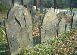
Considered to be the geographical center of the town, this area was known as “The Center.” Norwich’s first meeting house was built just south of the burial ground, completed in 1785. That year Norwich hosted the Vermont state legislature, which held sessions in the meeting house for 16 days.
 Stop 6: Meeting House Farm
128 Union Village Road
This house was built by Constant Murdock. Inside there is a central hall with a Palladian window. 18th-century landscape murals survive in two of the rooms. It is said that the lumber from the old meeting house was used to partially build the barn, thus the name “Meeting House Farm.”
 Stop 7: Captain Paul Brigham House
211 Brigham Hill Road
This cluster of homes all once belonged to the Brigham family. Captain Paul Brigham, a Revolutionary War solder, came to Norwich in 1782, bringing his wife Lydia and family with him. He served 22 terms as Vermont’s lieutenant governor. The Brigham family had a very close relationship with local Abenaki people and visits to the farm by an Abenaki extended family continued into the 1920s and 1930s. Video Tour of Brigham Hill
 Stop 8: Norwich Historical Society
277 Main Street
This home was built by Joseph Burton, here on what was once called “Burton’s Plain” or “the Plain.” Two rooms on the north side of the house became William Lewis’s town clerk’s office for 49 years. The house is now the location of Norwich Historical Society.
Unable to get out and drive? Here it is on YouTube thanks to CATV.
Credits
Produced by the Norwich Historical Society with support from the Norwich Historic Preservation Commission. Brian Knight and Lyssa Papazian researched and prepared the National Register Nominations associated with this tour. Thanks to Donna L. Moody, Director, and John Moody, Project Coordinator and Ethnohistorian for Winter Center for Indigenous Traditions for sharing their knowledge of Norwich’s Abenaki history. Jonathan Frishtick developed our map and Doug Lufkin designed the accompanying brochure. Thanks to CATV for the use of their recording studio.
Special thanks to the National Park Service for its contribution through the Certified Local Government Program, administered by the Vermont Division for Historic Preservation.
