
If you want the flip book at full-screen, click on the little arrows ![]() at the bottom right of the book.
at the bottom right of the book.

Thank you to the Norwich Women’s Club for funding this comic book!
To listen to the accompanying podcast on your phone, go to Apple Podcast and search for Norwich Historical Driving Tours.
or….Listen Here
Download Map Download Kids' Version Transcript Family Activities Download Rivers & Mills Comic Book
Narrated by Callie Guion
Tour Route
Begin and end the Driving Tour at Norwich Historical Society
277 Main Street
Continents collided, mountains tilted up. Mile-thick glaciers carved through the earth. Millions of years of water contoured this place. It’s the origin story of this place we call home.
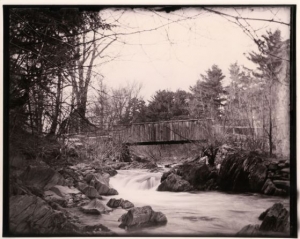
Bridge over Blood Brook
Stop 1. Water Power at Blood Brook
Elm Street Bridge
The ledge outcroppings at Blood Brook, pressed upward over millions of years, created a natural spot for harnessing water into ponds to power mills.

Pattersonville
Stop 2. Pattersonville
12 Campbell Flats Road
This is the site of the former Pattersonville Chair Company factory village, complete with worker housing, a general store, dance hall, and mill.
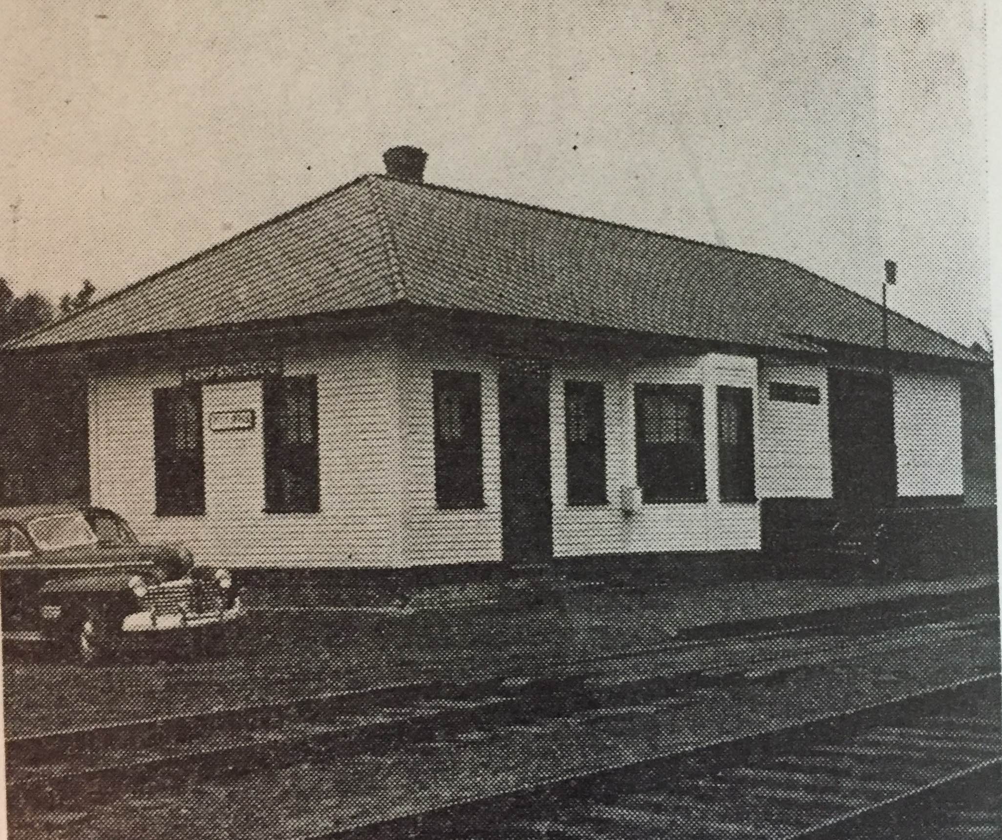
Pompanoosuc Train Station
Stop 3. The River as a Transportation Artery
Intersection of Old Bridge Road and Route 5
Across Route 5, Kendall Station Road leads to what was once a busy railroad station for freight, the Pattersonville Chair Company, and the Strafford copper mine.
Several vital transportation corridors, as well as a timeline of transportation history, can be seen from this location. The Connecticut River, the railroad, Vermont State Route 5, and Interstate 91 followed one after another through time.

Lewiston, looking toward Hanover
Stop 4. The Log Drives and the Hamlet of Lewiston
Ledyard Lane off River Road
The Lewiston area was home to Norwich’s first settlers, an important crossing to Hanover, and a transportation hub for Dartmouth

View of Lewiston and Ledyard Bridge from a Hanover hillside during the 1927 flood.
Stop 5. Across the River: Managing our Water
Ledyard Parking Lot, Boathouse Lane, Hanover, NH
The Union Village Dam and the Wilder Dam have both helped us manage flooding of communities downstream.
Credits
Produced by the Norwich Historical Society with support from the Norwich Historic Preservation Commission. The impetus for this podcast came from an architectural and archaeological survey conducted by Hartgen Archaeological Associates. Much of the information for this podcast was drawn from the writings of Brian Dade in Norwich, Vermont: A History, and in Proud to Live Here in the Connecticut River Valley of Vermont and New Hampshire, by Richard Ewald with Adair Mulligan. Thank you!
Jonathan Frishtick developed our map and Doug Lufkin designed the accompanying brochure. Dartmouth Printing Company provided printing of the brochure. Thanks to CATV for the use of their recording studio.
Special thanks to the National Park Service for its contribution through the Certified Local Government Program, administered by the Vermont Division for Historic Preservation.